http://news.yahoo.com/us-summer-global-warming-looks-064915370.html;_ylt=A2KLOzE_ovJPOHAAGwbQtDMD
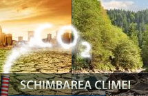
If you want a glimpse of some of the worst of global warming, scientists suggest taking a look at U.S. weather in recent weeks.
Horrendous wildfires. Oppressive heat waves. Devastating droughts. Flooding from giant deluges. And a powerful freak wind storm called a derecho.
These are the kinds of extremes climate scientists have predicted will come with climate change, although it's far too early to say that is the cause. Nor will they say global warming is the reason 3,215 daily high temperature records were set in the month of June.
Scientifically linking individual weather events to climate change takes intensive study, complicated mathematics, computer models and lots of time. Sometimes it isn't caused by global warming. Weather is always variable; freak things happen.
And this weather has been local. Europe, Asia and Africa aren't having similar disasters now, although they've had their own extreme events in recent years.
But since at least 1988, climate scientists have warned that climate change would bring, in general, increased heat waves, more droughts, more sudden downpours, more widespread wildfires and worsening storms. In the United States, those extremes are happening here and now.
So far this year, more than 2.1 million acres have burned in wildfires, more than 113 million people in the U.S. were in areas under extreme heat advisories last Friday, two-thirds of the country is experiencing drought, and earlier in June, deluges flooded Minnesota and Florida.
"This is what global warming looks like at the regional or personal level," said Jonathan Overpeck, professor of geosciences and atmospheric sciences at the University of Arizona. "The extra heat increases the odds of worse heat waves, droughts, storms and wildfire. This is certainly what I and many other climate scientists have been warning about."
Kevin Trenberth, head of climate analysis at the National Center for Atmospheric Research in fire-charred Colorado, said these are the very record-breaking conditions he has said would happen, but many people wouldn't listen. So it's I told-you-so time, he said.
As recently as March, a special report an extreme events and disasters by the Nobel Prize-winning Intergovernmental Panel on Climate Change warned of "unprecedented extreme weather and climate events." Its lead author, Chris Field of the Carnegie Institution and Stanford University, said Monday, "It's really dramatic how many of the patterns that we've talked about as the expression of the extremes are hitting the U.S. right now."
"What we're seeing really is a window into what global warming really looks like," said Princeton University geosciences and international affairs professor Michael Oppenheimer. "It looks like heat. It looks like fires. It looks like this kind of environmental disasters."
Oppenheimer said that on Thursday. That was before the East Coast was hit with triple-digit temperatures and before a derecho - an unusually strong, long-lived and large straight-line wind storm - blew through Chicago to Washington. The storm and its aftermath killed more than 20 people and left millions without electricity. Experts say it had energy readings five times that of normal thunderstorms.
Fueled by the record high heat, this was one of the most powerful of this type of storm in the region in recent history, said research meteorologist Harold Brooks of the National Severe Storm Laboratory in Norman, Okla. Scientists expect "non-tornadic wind events" like this one and other thunderstorms to increase with climate change because of the heat and instability, he said.
Such patterns haven't happened only in the past week or two. The spring and winter in the U.S. were the warmest on record and among the least snowy, setting the stage for the weather extremes to come, scientists say.
Since Jan. 1, the United States has set more than 40,000 hot temperature records, but fewer than 6,000 cold temperature records, according to the National Oceanic and Atmospheric Administration. Through most of last century, the U.S. used to set cold and hot records evenly, but in the first decade of this century America set two hot records for every cold one, said Jerry Meehl, a climate extreme expert at the National Center for Atmospheric Research. This year the ratio is about 7 hot to 1 cold. Some computer models say that ratio will hit 20-to-1 by midcentury, Meehl said.
"In the future you would expect larger, longer more intense heat waves and we've seen that in the last few summers," NOAA Climate Monitoring chief Derek Arndt said.
The 100-degree heat, drought, early snowpack melt and beetles waking from hibernation early to strip trees all combined to set the stage for the current unusual spread of wildfires in the West, said University of Montana ecosystems professor Steven Running, an expert on wildfires.
While at least 15 climate scientists told The Associated Press that this long hot U.S. summer is consistent with what is to be expected in global warming, history is full of such extremes, said John Christy at the University of Alabama in Huntsville. He's a global warming skeptic who says, "The guilty party in my view is Mother Nature."
But the vast majority of mainstream climate scientists, such as Meehl, disagree: "This is what global warming is like, and we'll see more of this as we go into the future."


